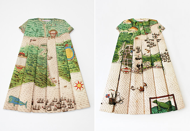
Paris 1550 (zoomable)
I always find old maps fascinating and the first thing I usually do is to try to find where I live on them. Unfortunately in 1550 my beloved 11th district was just a slum at the gates of Paris. It's right under the left end of the ribbon that contains the title. It's interesting to see the Bastille prison on this map since it was destroyed about 240 years later and has now been a big roundabout for the last two centuries.
Thanks to the incredibly high resolution of the file you can zoom and admire all the details of the illustrations of the map. Look for Notre-Dame for instance. It's easy, right in the center! It's one of the only famous monuments though that you can see on this map. The Louvres at that time was just a fort and not really the palace that you know of. It's very well represented on the map.
One of the odd things of this map is that it's not oriented to the north as modern maps usually are. The top part actually represents the east of Paris. So it's like if they operated a 45° rotation counter clockwise. Not sure why but I'd be curious to know the answer if you have any idea.
Zoom in the map, discover all its details and travel trough time to medieval Paris.
Found anything interesting?
Alex
Thanks to our friend Dwight for sending us this fantastic map!