The Monday Map: HejoMap
Over the summer all those ideas started boiling in our heads but it wasn't until we attended a workshop about OpenStreetMap à la Cantine that we decided to do actually do something. That event led by a passionate contributor of this open-source project was very inspiring but we’d still had to decide what to map. Or who.
Over the last two years we got quite involved in the Twitter travel community and got to love how it made the world such a smaller place. We kept reading about those travelers getting in touch via tweet and then meeting all over the world. For instance, we had the chance to meet @travelsofadam in Israel and then crossing his road again in Berlin. In the meantime he had met other travelers in Thailand that we had met in France, leaving us in awe to see how we were all connected now. Our map should allow us to visualize all those intersecting paths and where are our friends so we can make recommendations on who to meet and where.
We spent the month of August building a prototype and test it in our secret lab of Paris. We quickly realize that this could actually work and were eager to put it online quickly to test it with actual travelers. This how the @hejomap account came to life with a tiny bot analyzing mentions and #hejomap hastags of a selection of travelers to geolocalize them. Their position are then stored in a database feeding the map that you can here. The HejoMap project was born: a custom map featuring interesting people and projects updated real-time via Twitter.
>> Check the main page of the project here <<
We'd like to thank Michael, Jeannie and Nora who were the first people to actually use the system during their fantastic train journey. Using their input we were able to find dozens of bugs and correct them quickly before adding a second batch of traveling friends to the system and test it even more. Thanks to the help of all those first users, we are now proud to share the map with everybody and start adding more people again on the system.
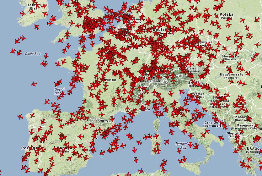
Map of the Ultimate Train Challenge
What now?
Obviously this is just the beginning of the adventure. We will now add more and more people over the coming weeks to make the project more interesting and useful. We want it to be our directory of awesome people around the world. A lot of websites have a "link love" page, we'll have a map! It will also feature all the interesting projects we come across like the fantastic journey of Tadpoles or the epic adventure of the UTC to inspire people to undertake this kind of journeys. We believe that sometimes only a map can really show you the real dimensions of crossing entire continents.
A lot more functionalities are coming too. For instance the option to link blog post to position updates. And also map your encounters with fellow travelers with specific markers. As usual we have tons of ideas so there will be very regular updates on the map.
Please go to the main page of the project and then let us know what you think about this project and if you have any ideas to improve it. We want to do this with you! If you'd like to get involved or know of any cool project that would make good use of this system, please get in touch with us at map@hejorama.com.
Team Hejorama
PS: this project was also a lot easier to achieve thanks to the Leaflet javascript library from Cloudmade which was introduced to us during the OpenStreetMap workshop.